Leaving behind Kyushu, where temperatures were still approaching 40°C even in September, I headed north to eastern Hokkaido in search of cooler weather. With September already halfway through, I was even hoping for some autumn colors on Mount Rausu. But Shiretoko, too, turned out to be surprisingly warm. The autumn and winter clothes filling my suitcase eventually returned to Kyushu without ever leaving their compression bags.
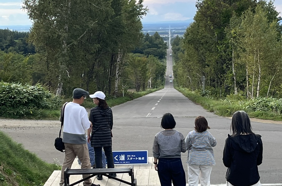
The journey began at Memanbetsu Airport. After a stop at the viewpoint overlooking the famous “Road to Heaven,” I followed National Route 334 toward Utoro, my destination for the night and a gateway to Shiretoko’s UNESCO World Heritage wilderness.
There are remarkably few traffic lights between Shari and Utoro. With such long, open stretches ahead, almost every road here feels as though it could lead straight to heaven.
Along the way, I stopped at the Onnebetsu River, hoping to see salmon swimming upstream. I was told that it was still a little early for the main salmon run and that fewer fish had been returning that year. In the end, I spotted only a handful of pink salmon—but even that small glimpse made the stop worthwhile.
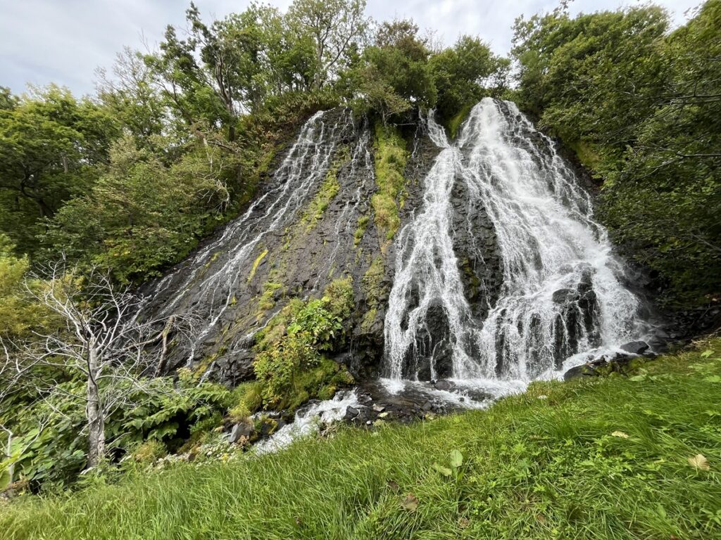
Next came Oshinkoshin Falls, a familiar sight in travel guides to Shiretoko. To be honest, it had not been especially high on my list, but I decided to take a look. In the unexpected Hokkaido heat, the cool air drifting off the waterfall turned out to be one of the day’s greatest pleasures.
ABOUT THE ROUTE AND STOPS
■ National Route 334
National Route 334 connects Bihoro with Rausu via Shari and Utoro. This video follows the approach to Utoro, where farmland gives way to coastal scenery beside the Sea of Okhotsk. Beyond Utoro, the route continues across the peninsula via Shiretoko Pass, linking its western and eastern sides. That mountain section is known as the Shiretoko Crossing Road and closes during winter.
■ The Road to Heaven — Ten ni Tsuzuku Michi
This celebrated view in Shari looks along an approximately 28.1-kilometer straight stretch incorporating National Routes 334 and 244. Seen from the elevated viewpoint, the road stretches toward the distant horizon and appears to climb into the sky—hence its memorable nickname. The classic view looks back toward Shari, so it is well worth stopping before continuing toward Utoro.
■ Onnebetsu River Salmon Viewing Area
Located beside Route 334, approximately 10 kilometers before Utoro when approaching from Shari, this riverside viewing area offers a chance to watch salmon returning upstream to spawn. Pink salmon, known in Japanese as karafuto-masu, and chum salmon return during the broader August–October season. What you actually see depends on the timing of your visit and the strength of that year’s run.
■ Oshinkoshin Falls
Right beside Route 334, Oshinkoshin Falls is one of Shiretoko’s best-known roadside sights. The waterfall drops approximately 30 meters and divides into two main streams, earning it the alternative name Sōbi no Taki, often translated as “Twin Beauties Falls.” Selected as one of Japan’s 100 finest waterfalls, it is reached by a short walk from the parking area, with steps leading to a closer view of the cascading water.
VIEWING NOTE
The dashcam footage is shown at twice normal speed. If you are prone to motion sickness, please take breaks or reduce the playback speed.
Travel: On the Road
© FS Publishing